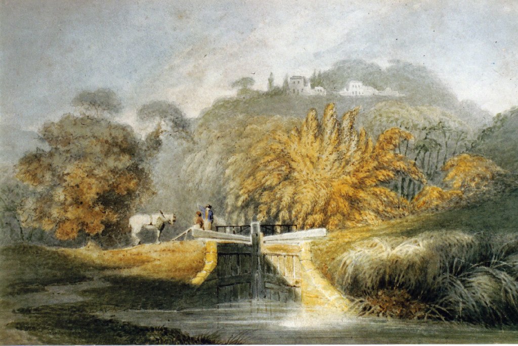
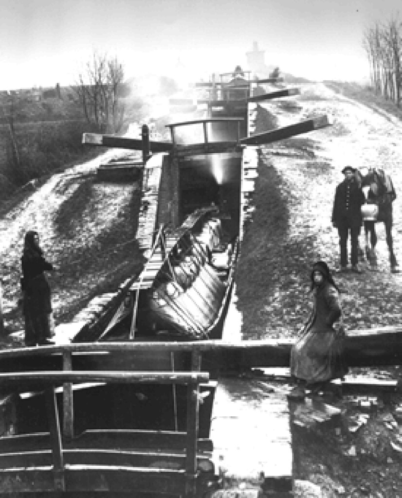
some interting stuff in that caption, eh?
Quote:
'the bank and boundary fence.... marked the old line of the canal'
It's wrong mate... Just like the website and Retracing book have got other details wrong. I agree with you that the bridge must be the Dead Lane bridge, as opposed to the Brockley Way bridge. I feel we are looking into this in more detail than anyone else has bothered to do so before us. Perhaps we are taking things just that little bit too far, but it's all good!

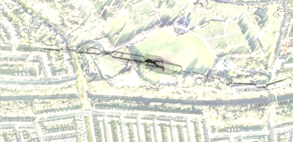
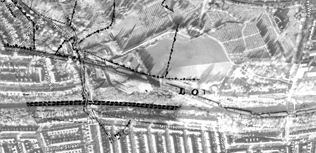
I'm sure you've already got the Honor Oak section of the canal lined up pretty accurately, and that's the most important thing; it certainly meets the following criteria:
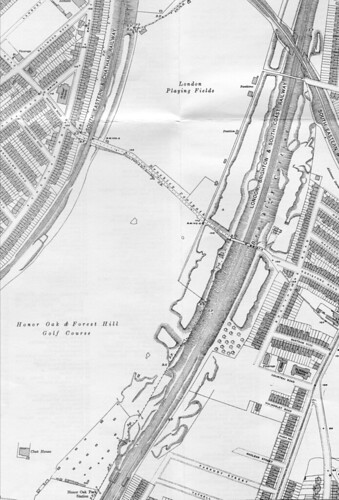
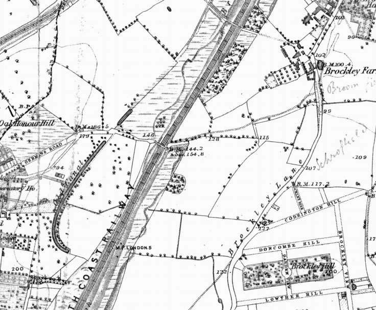
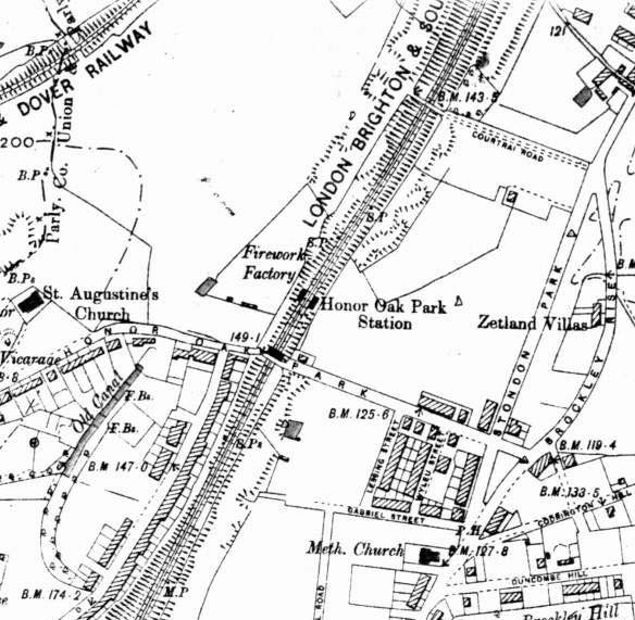
1) Correct angle established on leaving Honor Oak Park towards Deptford.
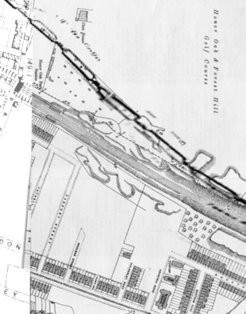
2) The canal is hitting the banks at the tennis courts and doesn't pass over the 2 gardens of the Crematorium.
3) The canal reaches the eastern bank at Brockley Way then follows the same alignment of the railway.
All locks seem well superimposed. We've established a bridge of some kind went over Dalrymple Road in the later years of the canal (probably built in 1833-1834).
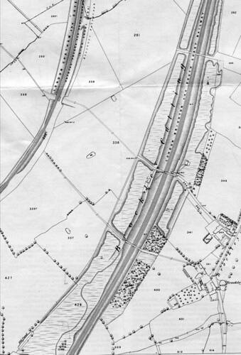
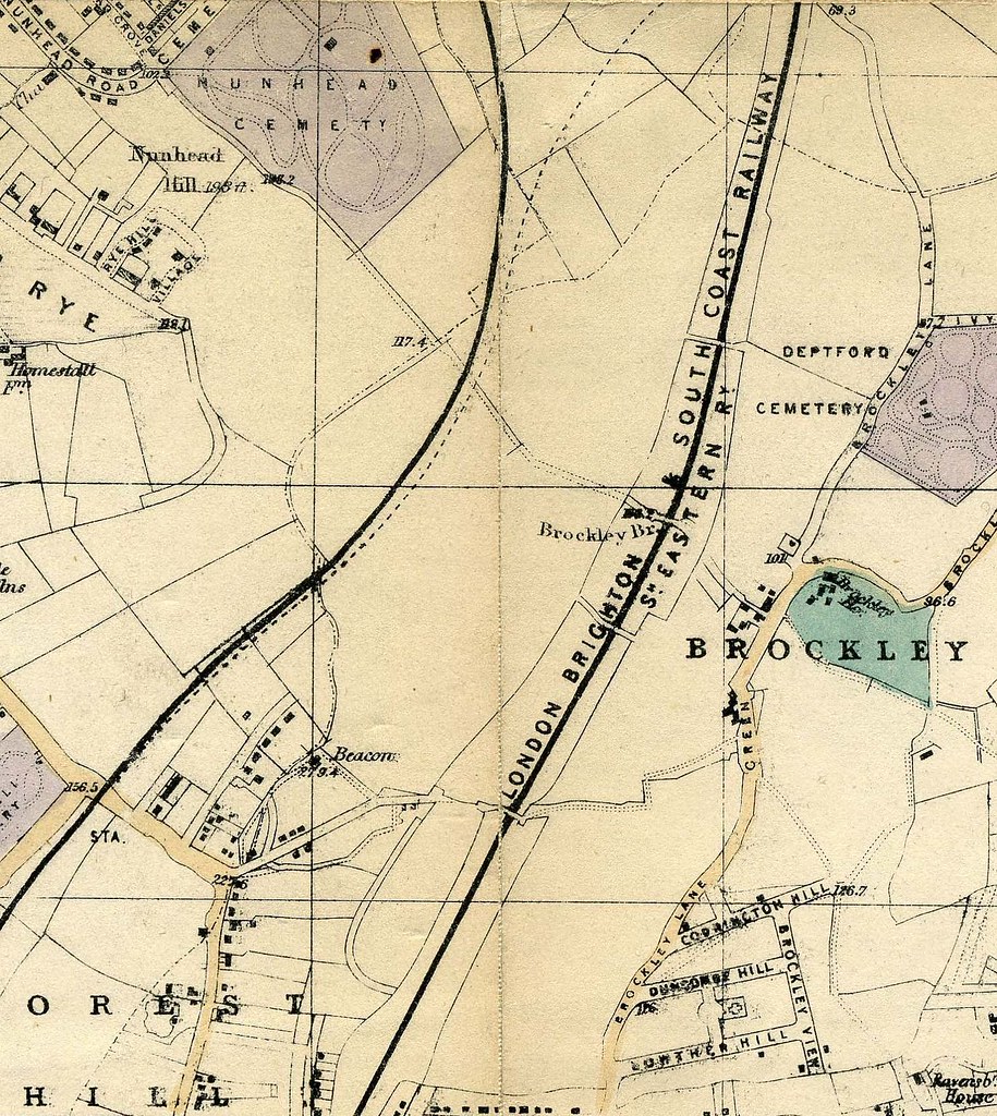
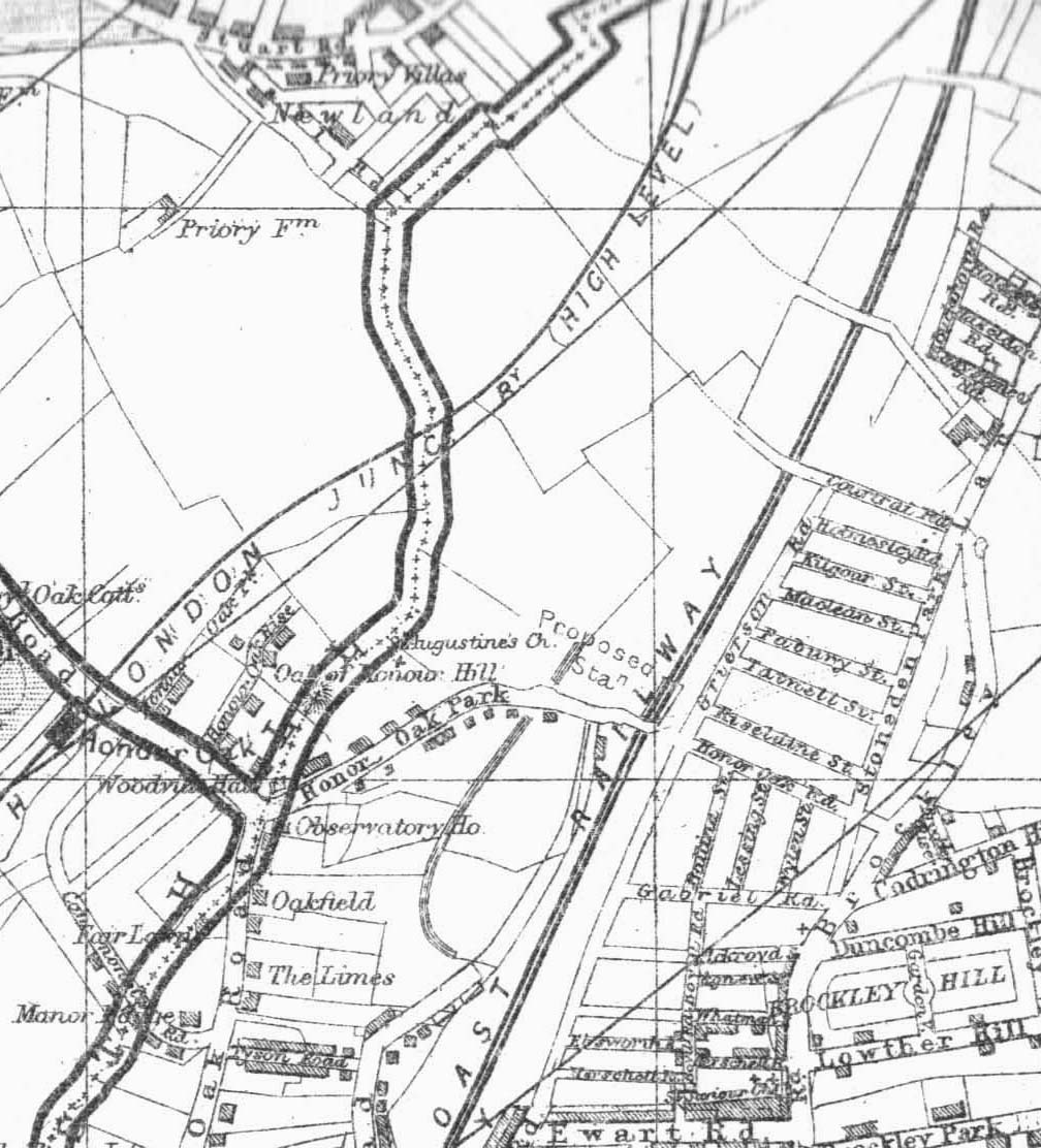
I'm pretty sure the towpath did not switch sides like you describe, and I'm sure it can be made out in the "official plans"--especially when you study the Brockley Cross section; more details are shown in relation to the towpath acting as a road. Scans would have been ideal to make out the towpath in these plans, and I'm atleast hoping to get some straight photocopies. BTW, these maps/plans were apparently surveyed in 1834 or 1835, and are clearly the most accurate. I don't even know why the Retracing book is bothering to debate which maps to consult and which is the most reliable? What we refer to as the "official plans" (thought they're not official as such) are clearly the most accurate and reliable--atleast for the later years of the canal. I can say that with much confidence. Just try comparing them with the 1833 map, for example--it's
obvious!
There is no connection between hedges, embankment, towpath and canal. I do feel we need to study the maps/banks to try and help us interpret that old photo, but not to help us with the canal--you've already completed your work here, Will, with more than satisfactory results, in fact, innovative.
I am also intrigued as to how far down you think you will need to dig to find any evidence of a lock.
Unless they levelled off the playing fields in a 1 mile radius, the banks are practically on the same level as the surrounding land. Obviously, the railway cutting goes extremely low down, but that doesn't necessarily mean the canal was this low. Looking at the level of the surrounding houses and land, the railway seems to have been built deep underground--not the other way round.
http://farm3.static.flickr.com/2400/223 ... 0432_b.jpg
I'm not at all certain this is even Honor Oak Park...
That embankment is definitely the western bank of the canal!
It can't be... It brings the canal way to the west. You need to be trying to match surrounding features to the canal--not try and fit the canal into the surrounding features. We've proven with hard corroborated evidence that the canal ran to east, as correctly represented by your last Google Maps update. Forget the embankment in relation to the canal. The book has it wrong, just like no book has a better chance of interpreting the painting near Dead Lane. A lot of this is guess work, but from the amount of research we've been doing, I'd have a little bit more faith in us.


